Click Here for Vector Map (91 KB)
Distinguished by its elliptical shape and elegantly poleward curving parallels, the Hammer-Aitoff Projection§¦ was introduced by Ernst Hammer in 1892. This equal-area ellipse is derived from the circular Azimuthal Equal Area Projection by halving the vertical coordinates and doubling the distance of the meridians from the center. The curvature of the parallels lessens the distortion of shape apparent at the extremes of the similar Mollweide Projection, which is also elliptical but has straight parallels. It is well-suited and widely used for world-wide statistical thematic maps.
Projected inside AutoCAD® by Ptolemytm map projection software by W. Murray Sexton, from the Micro World Database, available from the U.S. Central Intelligence Agency.
§ Frederick Pearson, II, Map Projections: Theory and Applications, CRC Press, Boca Raton, FL, 1990, pp. 149-152.
¦John P. Snyder, Map Projections--A Working Manual, U.S. Geological Survey Professional Paper 1395, U.S. Government Printing Office, Washington D.C., 1987, p. 182.
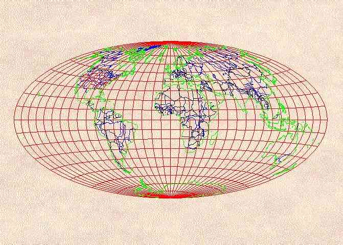
Hammer-Aitoff
Hammer-Aitoff Copyright © 1995 W. Murray Sexton. All rights reserved.


Scroll down for description.
Click East for next map.
Click North to return to list.