The Collignon Projection, named for its inventor, fits the world into a triangle with equally spaced parallels, and meridians which meet at the pole and are equally spaced at the equator. The resulting map has little cartographic value, having none of the qualities mapmakers ordinarily seek: it is neither equal-area nor conformal; neither angles nor distances are true; and scale varies widely across the map. Its sole advantage is artistic: in the form presented here, the Collignon is interrupted into eight sections arranged in a butterfly. Cut out and suitably folded and glued, the map can be formed into the eight-sided three-dimensional figure known as an octahedron, with the hemispheres forming two pyramids connected at their bases.
Projected by custom software by W. Murray Sexton from VersaMap 2.01, a version of the Central Intelligence Agencys Micro World Database by Charles Culberson http://www.members.aol.com/versamap, last updated July 1998 to show recent changes to national boundaries and many more islands.

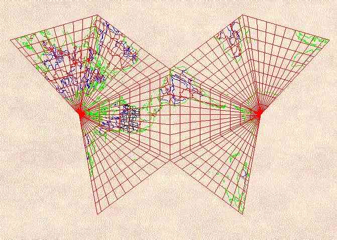
Butterfly Collignon
Butterfly Collignon (c) 2000 W. Murray Sexton. All rights reserved.


Scroll down for description.
Click East for next map.
Click North to return to list.